
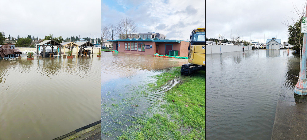
According to an alert by the National Weather Service (NWS), heavy rain and rising snow levels are leading to the expectation that the rivers are expected to be rapidly rising. Many rivers are expected to reach a flood stage late Monday night or Tuesday.
Tumwater, Lacey and Olympia are named in list of potentially affected cities where there is a flood watch.
The impacts that are projected possibilities are:
Western Washington under increased threat of landslides
“Heavy rainfall today through Tuesday night will lead to an increased threat of landslides in Western Washington,” stated NWS in a Special Weather Alert.
The soil moisture content increased over the last three days due to one to five inches of rain. The additional rain expected through Tuesday night, expected at around 2.5 to five inches of rain,.
“This amount of rain will put extra pressure on soil instability, leading to an increased threat of landslides and debris flows,” said NWS.
To learn more about the current conditions, go to www.weather.gov/seattle and select the Hydrology option. For Thurston County River Flood Monitoring, click here. For Olympia information on preparedness for Downtown Flooding, click here.


Comments
No comments on this item Please log in to comment by clicking here