
City staff proposed to make substantial zoning changes in several areas in Tumwater as a part of the Joint Tumwater / Thurston County Plan.
The proposed zoning changes were presented during the Tumwater City Council work session yesterday. These changes are considered as the first “substantial” amendments to the Joint Plan since it was adopted in 1995.
However, the amendments needed to be approved by both the Tumwater City Council and the Board of County Commissioners before its implementation.
The amendments include the following locations:
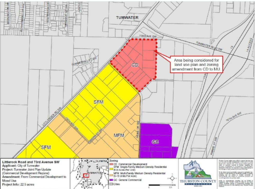
Littlerock Road and 73 Avenue SW
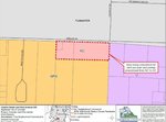
In his presentation, Tumwater Planning Manager Brad Medrud shared that some of the zoning changes include changing the city’s Commercial Development (CD) zone to Mixed Use (MU). The area in consideration covers 19 parcels of land between Littlerock Road and 73 Avenue SW.
Once approved, Tumwater will no longer have a designated Commercial Development zone.
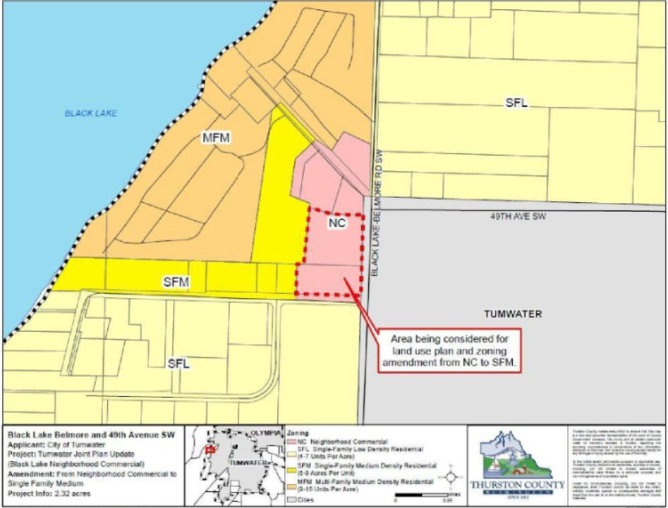
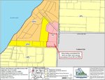
Black Lake-Belmore Road and 49th Avenue SW
Staff proposes that two parcels of land between the intersection of the Black Lake-Belmore Road and 49th Avenue SW should be reclassified from Neighborhood Commercial (NC) to Single Family Medium Density Residential (SFM). The zoning amendments are meant to give way for redevelopment of the 2.3-acre area.
Medrud explained that the staff had reviewed the size, and the location’s potential for development as their basis for the zoning amendment. Currently, the area is being developed for single-family homes.
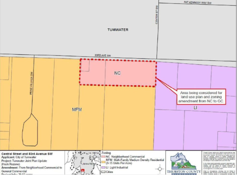
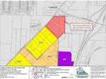
Center Street and 83rd Avenue SW
In addition to the proposed amendments along Black Lake-Belmore Road, the city staff is also proposing to change two parcels at the northern end of Center Street and 83rd Avenue SW. Initially, the properties were classified as NC, however, the staff believed that it is more appropriate to classify the property as General Commercial (GC).
The proposal was based on its neighboring areas which are surrounded by property under different zoning classifications including light industrial, residential, and airport-related. One of the parcels contains a small private RV park, while the other contains a single-family residence, with both areas covering a total of 7.6 acres.
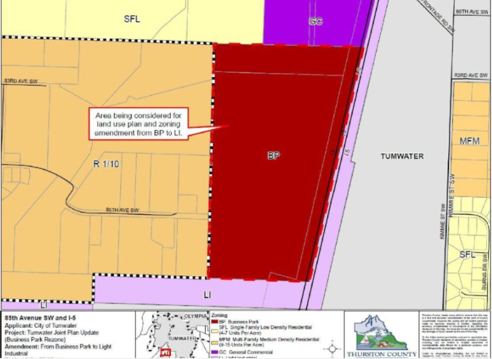
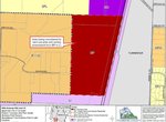
85th Avenue and Interstate-5
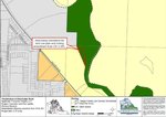
One of the biggest changes in the joint plan is changing the Business Park (BP) zoning along 85th Avenue and Interstate-5 to Light Industrial (LI). The city had already made these changes in 2017 under a city ordinance, and asked the county to do the same.
While the proposed amendment covers only one parcel of land, the area in consideration covers a total of 75.36 acres.
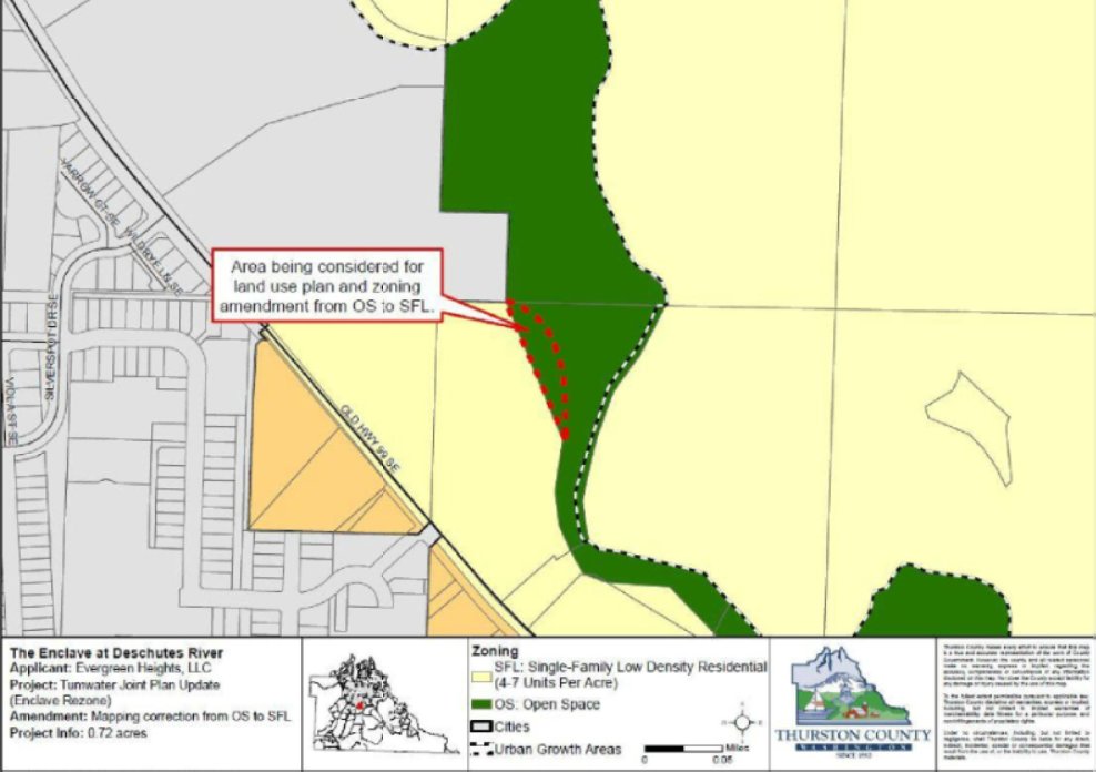
The Enclave at Deschutes River
The staff is also proposing to correct a mapping error between the Old Highway 99 and the Deschutes River. Under the current joint plan, the two areas are split between Single Family Low Density Residential and Open Space (OS).
The property owner requested to correct the error by changing 0.5 acres of Open Space into a Single Family Low Density Residential. These changes would not affect the regulations that were indicated in the Shoreline Master Plan (SMP).


Comments
No comments on this item Please log in to comment by clicking here